Showing posts with label George Washington. Show all posts

Thursday, June 11, 2020

Geo Washington's (1732-1799) Gardeners at Mount Vernon


George Washington cared deeply about the appearance of his gardens, in both style & type of flora, & closely supervised the planting process at Mount Vernon. He demonstrated his love of the United States through the types of native flora that he planted on his estate. After Washington retired, first from war & then from politics, he fulfilled the image of a gentleman planter, using Mount Vernon as his own personal statement of independence & republican simplicity.

Washington loved his gardens & was constantly changing the plants used at Mount Vernon. There is little evidence to suggest, however, that he was the one gardening. There were many gardeners who worked at Mount Vernon, several of whom were indentured servants. For example, letters written from Washington to his estate manager, Lund Washington, & to John Washington, an acquaintance from King George City, Virginia, reveal that Philip Bateman served as the primary gardener at Mount Vernon between 1773 & 1785...

George Washington purchased Bateman as an indentured servant for £35 in 1773, but continued to employ his services long after the term of indenture had ended... Records indicate that an individual with the last name Bateman was still at the Mount Vernon Estate until 1787, although there is no record to confirm that it was the same Bateman. On March 20, 1773, George Washington wrote to thank John Washington for finding him a promising gardener.3 Evidence in Washington's diaries suggests that Bateman stayed at least until December 1785, around the same time Lund Washington was preparing to end his tenure as the estate manager of Mount Vernon... There is a possibility that Bateman stayed at Mount Vernon longer, perhaps under the name Philip Bater, who on April 23, 1787, agreed to continue to work at Mount Vernon for at least one more year...

Very little is known about Bateman aside from the fact that he was the gardener at Mount Vernon from 1773 to at least 1785. Although Lund Washington appreciated Bateman's talents, he did not think highly of the gardener's intellect. In October 1783, Lund Washington wrote to George Washington: "As to Bateman (the Old Gardener) I have no expectation of his ever seeking Another home—indulge him in getg Drunk now & then, & he will be happy—he is the best kitchen Gardener to be met with..."  Bateman was clearly loyal to the Washingtons & to Mount Vernon, but from the very few letters & records that mention his name it is difficult to ascertain his fate after he ended his work at Mount Vernon.

After Bateman's departure from Mount Vernon, George Washington hired a German gardener named Johann (John) Christian Ehlers who worked on the estate from 1789 to 1797. Although Washington employed Ehlers for nearly ten years, he was constantly troubled by Ehler's work ethic & drinking habits. In 1792, Washington warned his estate manager at the time, Anthony Whiting, about Ehlers: "It is my desire also that Mr. Butler will pay some attention to the conduct of the Gardener & the hands who are at work with him; so far as to see that they are not idle; for, though I will not charge them with idleness, I cannot forbear saying . . . that the matters entrusted to him appear to me to progress amazingly slow..."

Ehlers evidently did not reform his behavior. In December 1793, Washington scolded the gardener, writing, "I shall not close this letter without exhorting you to refrain from spiritous liquors—they will prove your ruin if you do not … Don’t let this be your case. Shew yourself more of a man, & a Christian, than to yield to so intolerable a vice; which cannot, I am certain (to the greatest lover of liquor) give more pleasure to sip in the poison (for it is no better) than the consequences of it in bad behaviour at the moment, & the more serious evils produced by it afterwards, must give pain..." Washington ultimately parted ways with Ehlers in 1797.

While Ehlers was still employed by Washington, another gardener named John Gottleib Richler also worked at Mount Vernon. Richler was a German servant indentured for three years in return for Washington paying for his passage from Germany to the United States...  Otherwise not much is known about Richler [not Ehlers], who presumably left Mount Vernon after his term of indenture ended.

There were many other gardeners who worked at Mount Vernon, but their personal information is scarce. Two of these gardeners were David Cowan & William Spence. David Cowan worked for Washington for a little over a year between 1773 & 1774. William Spence was hired to work at Mount Vernon as a gardener in 1797, & stayed on after Washington's death in 1799.

There is no evidence that George Washington did any physical gardening himself at Mount Vernon, but his influence on activities was still apparent. His designs determined what plants were included & how the gardens appeared. Washington was directly involved in the development & redesigning of the gardens around the mansion, especially during his two separate retirements between 1784 & 1789 & from 1779 to 1799...

Washington contributed to the look of several natural spaces at Mount Vernon, including, the vista approaching the house, the Bowling Green, & the upper & lower walled gardens. For each garden area, Washington specified the types of plants & features that he wanted. In the Bowling Green, for example, Washington had the area shaped perfectly flat, using rollers to compress the earth & planted with velvety English grass to create a lush setting.

Surrounding the Bowling Green, Washington chose shrubs & trees planted around the walkways to reflect his design aesthetic. Washington desired to have native North American plant species in his gardens to represent the splendor of flora found in the United States. In his letters, Washington wrote that he wanted "philadelphus coronarius, as sweet flowering shrub (called mock Orange)," "Pinus Strobus," "Prunis Divaricata," "Hydrangia arborescens," & "Laurus nobilis..."  Washington exercised similar influence over each of Mount Vernon’s gardens.

Research plus images & much more are available from Geo Washington's (1732-1799) home Mount Vernon website, MountVernon.org. 

Wednesday, March 20, 2019

Teenage Geo Washington (1732-1799)- Professional Landscape Surveyor


Founders Online explains George Washington's (1732-1799) Surveying Appointment:   22 July 1749–25 October 1752

Between the ages of 17 & 20 GW was a practicing professional land surveyor. During that time he made more than 190 surveys, nearly all of them for grants of new lands on the frontiers of Lord Fairfax’s Northern Neck Proprietary. Frontier surveying was a lucrative business in Virginia at the middle of the eighteenth century, as swarms of settlers & speculators laid claim to the colony’s western lands, both inside & outside the Northern Neck. A diligent frontier surveyor working only a few months out of the year could clear annually £100 or more in Virginia current money, a cash income greater than that of most planters & tradesmen in the colony. Frontier surveyors, in addition, had ample opportunities to patent choice tracts of land in their own names, & many acquired holdings of several thousand acres. Surveying was a respectable occupation for a young Virginian in 1749, roughly on a par with law, medicine, the church, or military service, & most of the surveyors were drawn from the Virginia gentry.

GW’s career as a surveyor owed much to the Fairfax family. Close acquaintance with the proprietor, Thomas, Lord Fairfax, & with Fairfax’s relatives at Belvoir assured GW of receiving profitable surveying assignments in the Northern Neck, & it was probably at the behest of Lord Fairfax & through the agency of William Fairfax, who sat on the governor’s council, that GW obtained the surveyorship of Culpeper County at the start of his professional career. Young men of 17 usually did not serve as county surveyors. Most novice surveyors began as apprentices or deputies to county surveyors & did not become county surveyors themselves, if ever, until they had had some years of experience. Before 20 July 1749, nevertheless, GW received a commission from the president & masters of the College of William & Mary appointing him surveyor of newly formed Culpeper County. The college in its charter of 1693 had been granted the power to appoint all Virginia county surveyors & the right to collect one-sixth of their surveying fees, but in practice the college authorities were more concerned with their income than with who was appointed to the surveyorships. They regularly deferred to the wishes of powerful men in commissioning surveyors, & in the case of Culpeper, which lay in the Northern Neck, they were undoubtedly open to any suggestion that Lord Fairfax might make for the county’s surveyor. GW did not study at the college to qualify for the commission or stand any examination by the president & masters of the school. There is no evidence, in fact, that GW went to Williamsburg in the spring or summer of 1749. Most probably, William Fairfax, who attended council in Williamsburg from March to May 1749, secured the commission for him. On 20 July 1749 GW appeared before the justices of the Culpeper court &, after presenting his commission, took the oaths of public office for the first time & became the county’s first surveyor.

Two days later GW ran a survey of 400 acres on Flat Run in east central Culpeper County for Richard Barnes of Richmond County. GW decorated his plat of the survey with a handsome compass rose & a sketch of Mount Pony, an area landmark, & signed his name in full with his new title “Survy of Culpeper Cty.” It is the only survey that he is known to have made in the county in which he was commissioned. Thereafter, his surveying was done almost entirely in the Shenandoah & Cacapon valleys of Frederick County, which until 1753 embraced all of the Northern Neck Proprietary west of the Blue Ridge Mountains. Surveyors in the Northern Neck, unlike surveyors in the rest of Virginia, were allowed, at Lord Fairfax’s pleasure, to make public surveys outside the counties to which they were appointed. Under those circumstances it is not surprising that GW chose to survey on the frontier. Culpeper, although a new county, was fairly well settled. Most of its desirable lands had been surveyed & granted while it was part of Orange County, whereas on the other side of the Blue Ridge, in Frederick County, people were claiming many vacant tracts in 1749, providing a great deal of lucrative business for a surveyor...

Because in Virginia one could not legally make public surveys without a commission as a county surveyor, an assistant county surveyor, or special surveyor, the inclusion of GW’s title on these surveys was an indication that they were legitimate...The absence of any title at all on GW’s surveys after he stopped using “S.C.C.” suggests that he may have become one of the several assistants to Frederick County surveyor James Wood, since Frederick County assistants signed their surveys without title...Lord Fairfax continued to allow GW to survey for grants after he ceased to be surveyor of Culpeper County & that no one challenged the legitimacy of his work.
GW usually received his surveying assignments in packets of land warrants issued from the Proprietary land office at Belvoir. Addressed to GW & signed by William Fairfax, as the proprietor’s agent, or by William’s son George William Fairfax on behalf of his father, these documents instructed GW to survey an approximate acreage for a specific person at a general location by a certain date, normally 5 to 6 months from the date of the warrant...His surveys were often simple & near each other & sometimes had the additional advantage of being contiguous, making it possible to use one or more boundaries for two tracts. On at least  occasions GW was able to do four surveys in a day & on at least 13 other occasions three surveys in a day. At other times, of course, he worked more slowly, because the surveys were large or complex or there was some distance to travel between them.

GW, like most frontier surveyors, usually surveyed in the spring & fall, when the weather was most pleasant, snakes & insects were least troublesome, & the thin foliage of trees made it easier to sight long boundary lines through wooded areas...

GW gave no reasons for quitting the profession of surveying after the fall of 1752, but there are two evident ones. As lucrative as surveying on the Northern Neck frontier was between 1749 & 1752, it offered only diminishing prospects for the future. The supply of desirable new lands was already beginning to run low in the Northern Neck by 1752, & the dominance of Lord Fairfax in the whole land-granting process prevented Northern Neck surveyors, whether they held county appointments or not, from establishing power bases of their own in the way many frontier surveyors in other parts of Virginia did...In addition, GW had a strong appetite for soldiering, whetted no doubt by the example of his half brother Lawrence. By the spring of 1752 GW had learned that the office of adjutant for the colony, an office that Lawrence held, was to be divided into districts. On 10 June 1752 he asked Lt. Gov. Robert Dinwiddie to consider him for the Northern Neck adjutancy. Instead, the council on 6 Nov. 1752 appointed him adjutant for southern Virginia with a salary of £100 a year. GW did not survey professionally thereafter, but throughout the remainder of his life he frequently employed his surveying skills for his own private purposes: to acquire new land by purchase or grant both east & west of the mountains, to find & defend the boundaries of his many holdings, & to divide them into profitable fields & tenements. As late as Nov. 1799 he spent 3 days on Difficult Run in northern Fairfax County running the lines of his land there & of a nearby tract that he hoped to buy. Only his death 5 weeks later put an end to his surveying...

Teenage Geo Washington's (1732-1799) Journal of his 1st Landscape Survey Adventure

A Journal of my Journey over the Mountains began Fryday the 11th. of March 1747/8  by George Washington (1732-1799)

[March 1748]
Began my Journey in Company with George Fairfax Esqr.; we travell’d this day 40 Miles to Mr. George Neavels in Prince William County.

In 1746 & 1748, young George Fairfax (1724-1787) son of Wm Fairfax, took part in expeditions to survey Lord Fairfax's western land. George Washington, age 16, accompanied him on the 2nd trip, & they became lifelong friends.  George Neville (Neavil) (d. 1774), a planter & land speculator, had settled on Cedar Run, then in Prince William County (now in Fauquier County), as early as 1730.

Saturday March 12th. This Morning Mr. James Genn the surveyor came to us. We travel’d over the Blue Ridge to Capt. Ashbys on Shannondoa River. Nothing remarkable happen’d.

John Ashby (1707–1789) was son of  Thomas Ashby, had settled in Stafford County in 1710. John was widely known as an Indian fighter

Sunday March 13. Rode to his Lordships Quarter about 4 Miles higher up the River we went through most beautiful Groves of Sugar Trees & spent the best part of the Day in admiring the Trees & richness of the Land.

GW probably was referring to land owned by Lord Fairfax on the east side of the Shannondoah River.

Monday 14th. We sent our Baggage to Capt. Hites (near Frederick Town) went ourselves down the River about 16 Miles to Capt. Isaac Penningtons (the Land exceeding Rich & Fertile all the way produces abundance of Grain Hemp Tobacco &c.) in order to Lay of some Lands on Cates Marsh & Long Marsh.

Jost Hite (d. 1760) was one of the leading land speculators and developers in Frederick, eventually settling families on a tract amounting to 94,000 acres. His land purchases involved him in a dispute with Lord Fairfax over ownership of his grants. The court case was settled in Hite’s favor in 1786, 26 years after his death.  Frederick Town is now Winchester, Va.  Isaac Pennington came to the Shenandoah Valley, about 1734 and settled a tract of some 600 acres on the south bank of Buck Marsh Run.  In 1750 GW surveyed a tract of land for him in Frederick County before he moved to South Carolina in the fall of 1754.

Tuesday 15th. We set out early with Intent to Run round the sd. Land but being taken in a Rain & it Increasing very fast obliged us to return. It clearing about one oClock & our time being too Precious to Loose we a second time ventured out & Worked hard till Night & then returnd to Penningtons we got our Suppers & was Lighted in to a Room & I not being so good a Woodsman as the rest of my Company striped my self very orderly & went in to the Bed as they call’d it when to my Surprize I found it to be nothing but a Little Straw—Matted together without Sheets or any thing else but only one Thread Bear blanket with double its Weight of Vermin such as Lice Fleas &c. I was glad to get up (as soon as the Light was carried from us) & put on my Cloths & Lay as my Companions. Had we not have been very tired, I am sure we should not have slep’d much that night. I made a Promise not to Sleep so from that time forward chusing rather to sleep in the open Air before a fire as will Appear hereafter.

On this day the party had surveyed a tract of land for George William Fairfax on Cates Marsh and Long Marsh, the “names of small streams which flow from the foothill of North mountain to the Shenandoah river and have along their course considerable meadow or marshy land” 

Wednesday 16th. We set out early & finish’d about one oClock & then Travell’d up to Frederick Town where our Baggage came to us. We cleaned ourselves (to get Rid of the Game we had catched the Night before) & took a Review of the Town & then return’d to our Lodgings where we had a good Dinner prepar’d for us Wine & Rum Punch in Plenty & a good Feather Bed with clean Sheets which was a very agreeable regale.

Thursday 17th. Rain’d till Ten oClock & then clearing we reached as far as Major Campbells one of there Burgesses about 25 Miles from Town. Nothing Remarkable this day nor Night but that we had a Tolerable good Bed [to] lay on.

Andrew Campbell, who lived northwest of Winchester, and several other residents to keep ordinaries “at their respective houses” and to “furnish lodgings and food and Liquors at prices fixed by the court.”

Fryday 18th. We Travell’d up about 35 Miles to Thomas Barwicks on Potomack where we found the River so excessively high by Reason of the Great Rains that had fallen up about the Allegany Mountains as they told us which was then bringing down the melted Snow & that it would not be fordable for severall Days it was then above Six foot Higher than usual & was Rising. We agreed to stay till Monday. We this day call’d to see the Fam’d Warm Springs. We camped out in the field this Night. Nothing Remarkable happen’d till sunday the 20th.

Thomas Barwick (Berwick) was settled in Frederick County as early as 1744.

Sunday 20th. Finding the River not much abated we in the Evening Swam our horses over & carried them to Charles Polks in Maryland for Pasturage till the next Morning.

Monday 21st. We went over in a Canoe & Travell’d up Maryland side all the Day in a Continued Rain to Collo. Cresaps right against the Mouth of the South Branch about 40 Miles from Polks I believe the Worst Road that ever was trod by Man or Beast.

Thomas Cresap (1694–1790) immigrated to America about 1719, in 1736, and he moved to the vicinity of Shawnee Old Town (now Oldtown, Md.), where he built a fortified trading post at the crossroads of a series of trails much traveled by Indians and whites. Cresap acted as a surveyor and agent for the Ohio Company and helped lay out the company’s road from Wills Creek to the Monongahela.

Tuesday 22d. Continued Rain and the Freshes kept us at Cresaps.

Wednesday 23d. Rain’d till about two oClock & Clear’d when we were agreeably surpris’d at the sight of thirty odd Indians coming from War with only one Scalp. We had some Liquor with us of which we gave them Part it elevating there Spirits put them in the Humour of Dauncing of whom we had a War Daunce. There Manner of Dauncing is as follows Viz. They clear a Large Circle & make a great Fire in the Middle then seats themselves around it the Speaker makes a grand Speech telling them in what Manner they are to Daunce after he has finish’d the best Dauncer Jumps up as one awaked out of a Sleep & Runs & Jumps about the Ring in a most comicle Manner he is followd by the Rest then begins there Musicians to Play the Musick is a Pot half of Water with a Deerskin Streched over it as tight as it can & a goard with some Shott in it to Rattle & a Piece of an horses Tail tied to it to make it look fine the one keeps Rattling and the other Drumming all the While the others is Dauncing.

Fryday 25th. 1748. Nothing Remarkable on thursday but only being with the Indians all day so shall slip it. This day left Cresaps & went up to the Mouth of Patersons Creek & there swum our Horses over got over ourselves in a Canoe & travel’d up the following Part of the Day to Abram Johnstones 15 miles from the Mouth where we camped.

Patterson’s Creek flows into the Potomac about 12 miles below Cumberland, Md.

Saterday 26. Travelld up the Creek to Solomon Hedges Esqr. one of his Majestys Justices of the Peace for the County of Frederick where we camped. When we came to Supper there was neither a Cloth upon the Table nor a Knife to eat with but as good luck would have it we had Knives of [our] own.

Sunday 27th. Travell’d over to the South Branch (attended with the Esqr.) to Henry Vanmetriss in order to go about Intended Work of Lots.

John Van Meter, a New York state Indian trader who carried on an extensive trade among the Delaware Indians, visited Virginia about 1725. With his encouragement, his sons Isaac & John obtained extensive grants of land on the South Branch of the Potomac and in the lower Shenandoah Valley in 1730 and brought in a number of settlers.

Monday 28th. Travell’d up the Branch about 30 Miles to Mr. James Rutlidge’s Horse Jockey & about 70 Miles from the Mouth.

On 29 Mar. the party surveyed a tract of land for James Rutledge (surveying notes, DLC:GW). 

Tuesday 29th. This Morning went out & Survey’d five Hundred Acres of Land & went down to one Michael Stumps on the So. Fork of the Branch. On our way Shot two Wild Turkies.

Michael Stump, Sr. (1709–1768), received a grant on the South Fork of the South Branch of the Potomac, on 8 Sept. 1749

Wednesday 30th. This Morning began our Intended Business of Laying of Lots. We began at the Boundary Line of the Northern 10 Miles above Stumps & run of two Lots & returnd to Stumps.

Thursday 31st. Early this Morning one of our Men went out with the Gun & soon Returnd with two Wild Turkies. We then went to our Business. Run of three Lots & returnd to our Camping place at Stumps.

Surveying the Land - from Geo Washington's (1732-1799) Ferry Farm

George’s First Job - About The Land

When visitors come to George Washington’s Ferry Farm, they can stand in what were once the fields of the Washington family’s farm, where they grew tobacco and other crops. While living here, Augustine Washington, George’s father, taught his sons – George, Samuel, John Augustine, and Charles – to see opportunity in land.
Ferry Farm Aerial View
Aerial view of the present-day Washington house replica, work yard, hen yard, and archaeological digs at George Washington's Ferry Farm. Credit: Joe Brooks, EagleOne Photography

Growing up at Ferry Farm, George Washington learned that land was wealth. He learned how to run a plantation and to manage the enslaved workers who lived and toiled on his family’s farms. He learned what crops to grow and livestock to raise, how to care for them, and how to put them to use.  George Washington was many things at different points in his life – diplomat, politician, general, president –  but, throughout his sixty plus years, he was always a farmer.

To George and the other Europeans who settled in British North America in the 1700s, land and its natural resources were privately owned commodities or raw materials to be bought or sold. Land was used to create goods for market or was sold for profit.  In other words, land was valuable and owning a lot of land made you wealthy.

Before growing anything on a farm, Washington and his fellow colonial-era farmers had to own land and the land they owned had to be defined legally. It had to have boundaries, so they and other people knew it belong to them.  If land was wealth, it was vitally important to know how much land you owned.

Creating these boundaries was the job of a surveyor and being a surveyor was, after his lifelong work as a farmer, George Washington’s first job.
Young George Washington, Surveyor From National Park Service 

Merriam-Webster’s dictionary defines surveying as “determining the area of any portion of the earth’s surface.”

Today, surveyors use the Global Positioning System (GPS), satellite imagery, lasers, and other advanced digital equipment to do their work more quickly and more accurately. When George Washington was a surveyor, he used simple tools compared to today but, 200-years-ago, these simple tools were as advanced technologically speaking as today’s surveying equipment.  Indeed, in the 1700s, surveying was relatively brand new.  The word itself first appeared only in 1682.

Although a relatively new science, young George Washington was probably familiar with surveying from an early age.  His father Augustine owned “1 Set Surveyors Instruments,” according to the probate inventory made of Augustine’s property after his death in 1743.

The state-of-the-art instruments of a surveyor in the 1700s included a surveying compass on a tripod used to figure out the bearing and direction of a proposed boundary line.  A surveying compass included “sighting vanes” used to point “the compass by peering through the slit in one of the vanes and lining up the horsehair or wire in the oval of the other vane with a target or object” along boundary line.  These targets were often just trees (sometimes marked in some fashion with a hatchet), boulders, steams, or any other landmarks.
Surveyor's Compass by David Rittenhouse, believed to be given to George Washington in 1782. National Museum of American History 

Measuring the distance between these targets set the property’s boundaries as well as its acreage. These distances were measured using chains carried by the surveyor’s assistants known as chainmen.  A full surveyor's chain was 66 feet long and 100 links and eighty of these chains equaled one mile. “Dragging a sixty-six-foot chain through the brush of colonial Virginia's forests was impractical.” These long chains snagged on trees and other vegetation so surveyors in the colonies used a chain that was only 33 feet long with 50 links.
Surveyor's Chain, c1830. Credit: National Museum of American History / 

George Washington began a survey by choosing a starting landmark as well as a landmark to travel towards.  He recorded the direction of the line using his surveying compass.  Then, to measure the distance, the rear chainman held one end of the chain at the starting point while the lead chainman walked a straight line toward the ending target.  As the surveyor, George constantly checked the compass to make sure the chainmen followed his line.  Keeping the line straight sometimes meant the lead chainman hacked his way straight through brush and undergrowth.  Once the he reached the end of the chain, the lead chainman pinned it to the ground and the rear chainman brought up the other end. They then repeated the process until the ending point of the line was reached. The rear chainman picked up the pins as they walked.

Fifteen-year-old George Washington made one of his first surveys on February 27, 1747 when he measured out his older half-brother Lawrence’s turnip field at Mount Vernon. According to Ledger Book Zero, Washington bought a Gunter scale, essentially a two-foot long ruler specifically designed to solve the trigonometry problems common to surveying, from his cousin Baily on September 20, 1747.
Gunter's scale. Credit: MIT Museum

Thirteen months later, on March 11, 1748, George accompanied George William Fairfax and James Genn, the Surveyor of Prince William County, on a month-long trip across the Blue Ridge Mountains and into Virginia’s frontier to survey land for Thomas, Lord Fairfax.  Young Washington kept a journal of his experiences.

In 1749, at age 17, George was commissioned the surveyor of the new county of Culpepper by the College of William & Mary, which appointed all county surveyors in Virginia This was unusual for someone this young to be appointed.  A year later, he began a two-year period of off-and-on trips throughout Virginia’s Frederick County, which at the time encompassed a vast swath of frontier land that today makes up nine separate counties in two states.  “By 1752, Washington completed nearly 200 surveys totaling more than 60,000 acres.”

In the later 1750s, George began to focus his work life more on soldiering (the French and Indian War) and farming. He never completely stopped surveying or acquiring land, however. In 1771, he surveyed Ferry Farm in preparation to sell the property and he surveyed for the last time in 1799, the year he died.

In the colonial age, land was wealth and was how many colonials, including George Washington, made their living.  As such, early Americans wanted to know what land they owned as well as how much they owned.  Surveyors, like George Washington, measured the land and created boundaries so ownership would be clear.  “At one time, Washington owned nearly 70,000 acres between the Potomac and Ohio Rivers.”  Surveying was Washington’s first job and allowed him to begin to build vast amounts of land holdings and thus wealth. This wealth, in part, propelled him to the heights of colonial American society and politics.  He began this journey as a surveyor while living at Ferry Farm.

By Zac Cunningham, Manager of Educational Programs

Thursday, December 6, 2018

Plants in Early America - Trees needed a purpose at Geo Washington's (1732-1799) Boyhood Ferry Farm

This article comes from research at George Washington's boyhood home, Ferry Farm, in Virginia.  The lively blog Lives & Legacies tells stories of  George Washington's Ferry Farm and Historic Kenmore.

A History of Trees at Ferry Farm

by ferryfarmandkenmore
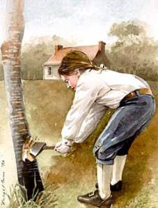
Cherry TreeThe moment anyone mentions trees and George Washington, you probably think of the famous Cherry Tree Story. However, this tale of young George taking a hatchet to his father cherry tree and, when confronted about the act, asserting "I cannot tell a lie" is probably just that -- a story meant to demonstrate the integrity of the Father of Our Country. In reality, the trees of Ferry Farm have a much more fascinating history. Their story reflects, on a small local scale, vast environmental changes in eastern North America and shifting American attitudes toward the environment throughout the 18th, 19th, and 20th centuries.
Today, we see wilderness as a good thing that needs protected and preserved. But in the 1700s, Europeans settlers saw wilderness as a bad thing. Preeminent environmental historian William Cronon notes, Europeans described wilderness as “’deserted,’ ‘savage,’ ‘desolate,’ ‘barren’—in short, a ‘waste,’.” People did not look at forests, deserts, or mountains as places to protect and visit. Instead, they were places to be feared and tamed.
The opposite of wilderness was the managed landscape of Europe. In cities, towns, and farms, Europeans tried to control nature and make it follow humanity’s rules.  These efforts to tame the wilderness were transplanted to colonial plantations in the Americas.
The first step in building a plantation and taming the wilderness was clearing the land for farming. Huge numbers of trees were cut down to do this.  On top of that, trees were cut down to make almost everything people of the 1700s and 1800s used and owned.  Furthermore, they were also cut down to do many everyday tasks.
Throughout the 18th and 19th centuries, the wood from trees was…
  • used as the main architectural building material in houses, most other structures, farm buildings, fences, and more
  • used to build ships, boats, ferries, bridges, carriages and wagons that moved people and things from place to place
  • used to make everyone’s furniture (beds, chairs, tables, desks, cabinets, and trunks) as well as many household items and farming tools
  • used as fuel for the fires needed to cook, heat, and even to make candles and soap. A colonial home needed at least 40 cords of wood for heating and cooking over the course of a year.

5 cords of Firewood 1
Five cords of firewood. A colonial home used 8 or 9 times this amount in a year for just heating and cooking. Credit: Chris Stevenson


5 cords of Firewood 2
Credit: Chris Stevenson

These large scale trends can be seen on a small scale at Ferry Farm.  The European settlers who lived here, including the Washingtons, cut down a significant number of trees but not so many that there weren’t still quite a few standing when John Gadsby Chapman painted Ferry Farm’s landscape in 1833.

1830s
"The Old Mansion of the Washington Family" (1833) by John Gadsby Chapman shows the foundation stones of the house where George grew up at Ferry Farm and trees along the riverbank.

We also have archaeological evidence showing the locations of trees during the Washington era.  This past summer in the yard north of the Washington house replica archaeologists uncovered “soil stains” left after trees fell in the past.  Soil stains are where the soil is a slightly different color than surrounding areas and indicate where people filled in holes created by uprooted trees. In other words, such soil stains indicate that a tree once stood there.

Uprooted Tree
A tree uprooted by a storm. Credit: ykaiavu / Pixabay

In some cases, our archaeologists found that the holes were filled in multiple episodes, indicating that the soil settled and new dirt was later added or the person filling the hole borrowed different dirt of different colors from multiple locations. By excavating the soil from these soil stains and analyzing the artifacts, we can tell around when the holes were filled.

Soil Stain
Soil stain marking the site of an 18th and 19th century tree on the landscape at George Washington's Ferry Farm.

One very large tree left the sizable soil stain – almost 5ft x 5ft – pictured above.  Based on artifacts found in its soil, the hole was filled during the mid-19th century.  We can tell by the size of the stain that the tree was quite mature. Together, these facts are evidence of a tree that grew just 40 feet north of the original Washington house during the time George and his family lived at Ferry Farm. This discovery gives us another detail about the landscape so it can eventually be accurately recreated just as we did the main house.
Finally, Ferry Farm archaeologists learned from these tree features and from the lack of other features in this yard that the area was well-kept. In the 18th century, this portion of the landscape was probably well-maintained because it was visible from Fredericksburg across the river.
This tree fell sometime in the 19th century and it was not the only one at Ferry Farm or across the country. Indeed, deforestation at Ferry Farm and nationwide grew more rapid and widespread in the 1800s as “clearing of forest land in the East between 1850 and 1900 averaged 13 square miles every day for 50 years; the most prolific period of forest clearing in U.S. history.”
In the 1860s, the Civil War exacerbated deforestation at Ferry Farm and throughout Stafford County.  Hundreds of thousands of Union Army soldiers radically altered the local environment to get the wood they needed for cooking and heating, to help build their fortifications and pontoon bridges, and even to build shelters.  During winter lulls in fighting, 18th and 19th century armies did not camp in tents. The soldiers built small log cabins.  By war’s end, Ferry Farm and Stafford County were nearly treeless as seen in the two photos of Ferry Farm below taken in the decades after the war ended.

1870s
View of Ferry Farm property in the 1870s.


1880s
View of the Ferry Farm property in the 1880s

As the 19th century turned into the 20th, wilderness, nature, and the environment were increasingly seen as special and deserving of protection and preservation, sparking the creation of national and state parks, government agencies like the Forest Service, private conservation groups such as the Sierra Club, and, in 1872, the very first Arbor Day.
We can see the impact of new attitudes toward the environment at Ferry Farm in photos below. The top one from the 1930s, a period of intense conservation efforts nationwide, shows trees starting to appear once again while the other from 2017 shows trees on a portion of Ferry Farm stretching out as far as the eye can see to the north.

1930
Aerial view of Ferry Farm taken in 1930.


2017
Aerial view of a portion of Ferry Farm and points north taken in 2017. Credit: Joe Brooks / Eagle One Photography

The early 20th century saw the nadir of American deforestation in 1910. But since that year, forest acres in the U.S. have largely held steady [PDF].  The new conservation ethic symbolized in the practice of planting trees to replace those cut down, the reduced use of wood as a building material and fuel source, the need for less farm land, and the movement of people from rural to urban areas (all of which present their own challenges to the environment) have provided a reprieve for America’s forests.
While George’s mythical chopping of the Cherry Tree is the most well-known tale about trees at Ferry Farm, the more important and fascinating story is how the 300 hundred year history of trees at Ferry Farm reflects broader post-settlement environmental changes in North America and how the Americans who made those changes grew to see the world differently.
Zac Cunningham
Manager of Educational Programs
Elyse Adams, Archaeologist
Archaeology Lab Technician